
Vancouver Tides
Tide times and heights in Vancouver, BC:
Today's Low Tide Schedule
Vancouver's tidal flats are only accessible during low tides with tidal heights low enough to expose the intertidal zone.
| Live Tide | ||
|---|---|---|
|
–
–
meters
Loading current conditions…
|
| Tide | Time | Height |
|---|---|---|
| Loading today's tide times… | ||
This tide schedule uses open data provided by the Canadian Hydrographic Service.
↓
Full Tide Schedule Below
↓
Walk Vancouver's Low Tides With Me
Ready to join me?
View dates and reserve your spot.
Explore Vancouver's tidal flats, coastal wildlife and striking natural landscapes only a short distance away from Downtown Vancouver.
Experience the Tidal Flats Only Accessible During Low Tide
Stretching out almost a kilometre at low tide along coastline, we'll explore the expansive tidal flats, wade through tide pools, walk out to a hidden sandbar, and watch for herons, eagles, seals, and if we're lucky, a whale.
As a local who knows these tides well, I'll safely guide you over the intertidal zone so you can reach the farthest points stretching into Burrard Inlet and the Strait of Georgia.
Each low tide walk is unique and is shaped by the day's tide, the season, and the wildlife we encounter.
Vancouver Tides Schedule
Use Vancouver's predicted low tide times and levels to safely plan your visit to the tidal flats.
Or book a Vancouver Low Tides Walking Tour with me. Each walk is carefully planned around the tidal range, lunar phase, seasonal variations, and my own local knowledge, so you can explore the tidal flats at their best and reach the farthest points stretching into the Strait of Georgia.
Each walk is carefully planned around the tidal range, lunar phase, seasonal variations, and my own local knowledge, so you can explore the tidal flats at their best and reach the farthest points stretching into the Strait of Georgia.
About Vancouver's Coastal Tides and Intertidal Zone
Vancouver experiences two high and two low tides every day that are shaped by the moon's gravitational pull on the earth.
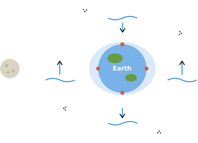
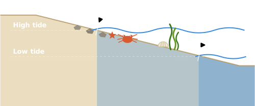
When the tide drops low enough, it reveals the intertidal zone that stretches between where the shoreline is exposed to air at low tide and submerged by the ocean at high tide.
This intertidal zone is home to a rich marine ecosystem that helps sustain life in the water and on land.
The tidal flats surrounding Locarno Beach and Spanish Banks support a rich ecosystem full of marine life. It's home to many resilient species that can survive a constantly shifting environment, shifting between saltwater at high tide, and baking sun, rain, or runoff at low tide.
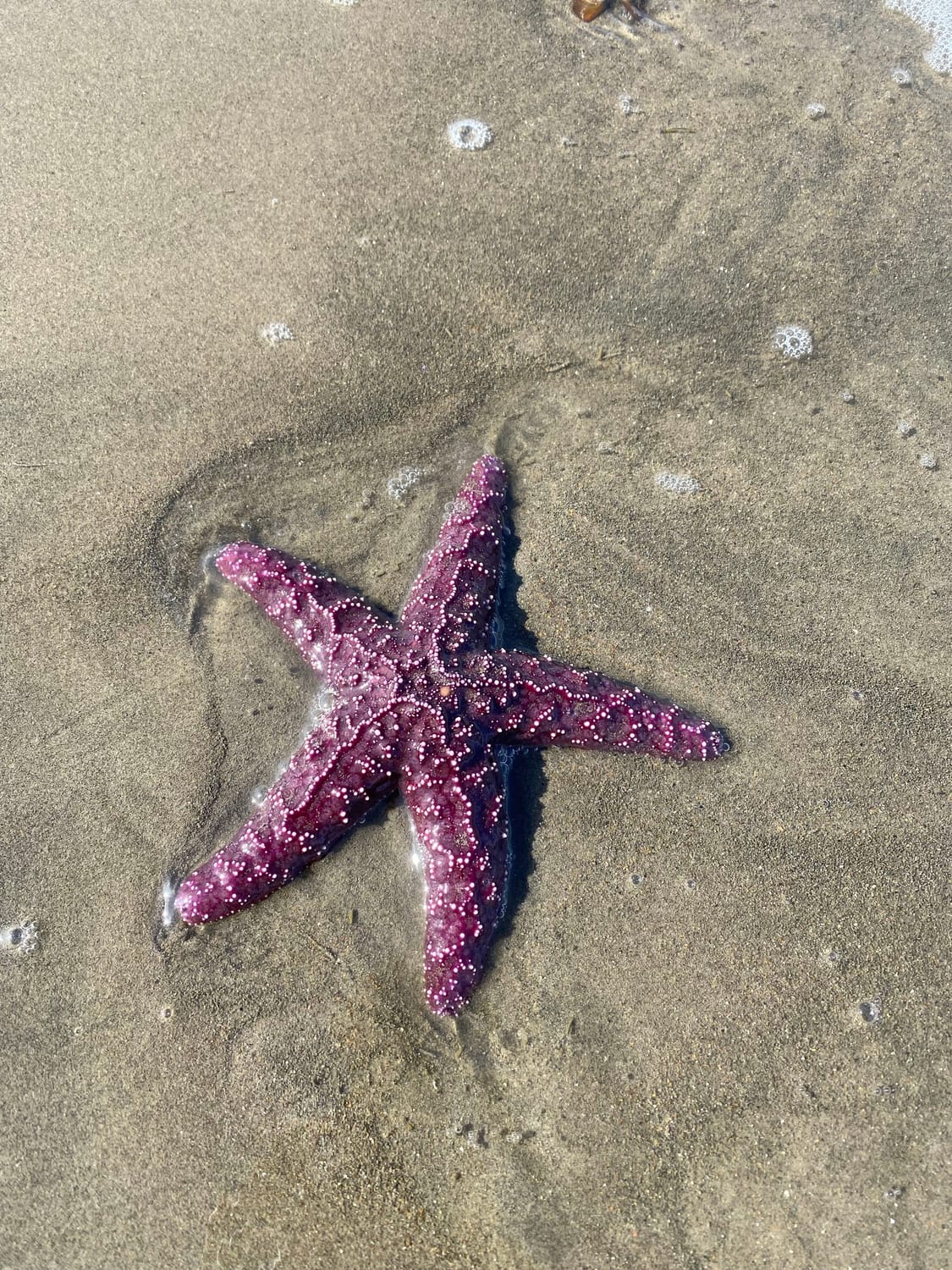
As a result, the intertidal zone acts as a nursery for many deep water marine species, providing shelter and food during the vulnerable early life stages for many organisms. Many different species of birds and local marine wildlife also forage for food within the intertidal zone.
Common Seashore Creatures
Barnacle
Sideswimmer (amphipod)
Rockweed Isopod
Purple Shore Crab
Hermit Crab
Limpet
Periwinkle Snail
Rockweed (seaweed)
Heart Cockle Clam
Mussel
Ribbon Worm
Nereis (Bristleworm)
Dungeness Crab
Sugar Kelp (seaweed)
Common Coastal Birds
Bald Eagle
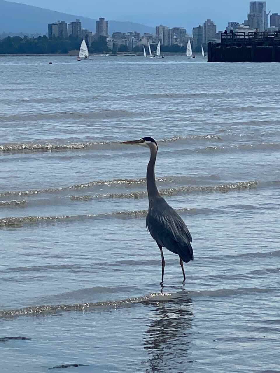
Great Blue Heron
Double-crested Cormorant
Pelagic Cormorant
Surf Scoter
Dunlin Sandpiper
Western Sandpiper
Black Turnstone
Barrow's Goldeneye
Bufflehead
Glaucous-winged Gull
Canada Goose
Common Loon
Sources & Further Learning
The Intertidal Zone – National Film Board of Canada (NFB)
How to Go with the Tide – WWF Canada
Seashore Creatures – Metro Vancouver Regional Parks
Identifying Shorebirds in British Columbia – Birds Canada
English Bay, Burrard Inlet & Howe Sound (BC020) – KBA Canada
Scoters and Other Birds Feeding on Purple Varnish Clams, Spanish Banks, Vancouver, British Columbia – British Columbia Birds (BCFO), Journal of the British Columbia Field Ornithologists
Tides are the periodic rise and fall of the water along ocean coasts that follows a rhythmic daily pattern.
Vancouver experiences two high and two low tides every 24 hours and 50 minutes.
The intertidal zone is the area of the coastal shoreline that is exposed to air at low tide and submerged by the ocean at high tide, and is home to a rich marine ecosystem that helps sustain life in the water and on land.
Types of Tides and Thier Impact on the Tidal Range
Tidal range is the difference in height between high tide and low tide.
The tidal range varies during the month according to phase of the moon.
The tidal range is the largest during the new and full moon phase and smallest during quarter moon phases.
The sun also influences the tidal range, adding an additional layer of complexity to the tidal patterns and creating a rhythm that varies throughout the year.
Non-astronomical factors also affect tides, including:
local water depth
coastline configurations
ocean-floor topography
Spring Tides and King Tides
Spring tides occur twice each lunar month when the sun, moon, and Earth align during the full and new moons and are characterized by higher high tides and lower low tides.
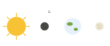
King tides (also known as perigean spring tides) are extreme high tide events that occur a few times per year when the sun and moon’s gravitation forces reinforce one another at times of the year when the moon is closest to the earth.
The highest King tides happen twice a year and are typically more dramatic during the winter.
Neap Tides
Neap tides occur when the sun and moon are at right angles to each other.
They happen twice a month during the first and third quarters of the moon.
They are caused by the gravitational force of the moon and the sun counteracting each other.
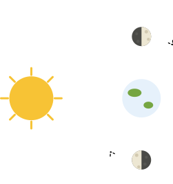
They are caused by the gravitational force of the moon and the sun counteracting each other.
During these periods, the difference between high tide and low tide is minimal, leading to less extreme tidal conditions and a smaller tidal range.
Neap tides play a significant role in the stability of marine environments, offering periods of minimal water movement that can be beneficial for the development of certain marine organisms.
Sources & Further Learning
About Tides and Currents – Fisheries and Oceans Canada
Intertidal Zone – Oceana Canada
King Tides Rule the Coasts – National Geographic Education
King tide – Wikipedia
Cause and Effect: Tides – National Geographic Education
Vancouver Tides
The following Vancouver tides schedule uses open data from the Canadian Hydrographic Service.
(Note: It may take a few moments for the tide schedule to load.)
Tours Guided By the Tides
All my low tide tours are carefully planned around the predicted low tide times and levels for Vancouver so you can safely explore the tidal flats at their best and reach the farthest points stretching into the Strait of Georgia
Eco-Friendly Sustainable Tours
I'm committed to hosting eco-friendly and sustainable walking tours that leave the beaches, trails and wildlife undisturbed.
I also recognize the invaluable role of the xʷməθkʷəy̓əm (Musqueam), Sḵwx̱wú7mesh (Squamish), and Sel̓íl̓witulh (Tsleil-Waututh) Nations as the original and ongoing stewards of this land.
Keeping It Low Impact
Keeping It Low Impact
Small group sizes, respecting wildlife and tidal ecosystems, and easy access from around Vancouver by bike or bus are just some of the ways I keep these walks low impact.
3% Donated To Tackling the Climate Crisis

3% Donated To Tackling the Climate Crisis
3% of all purchased tours will be contributed to the removal of CO₂ from the atmosphere.
Land Acknowledgement
I gratefully acknowledge that these walking tours take place within the unceded, ancestral territories of the xʷməθkʷəy̓əm (Musqueam), Sḵwx̱wú7mesh (Squamish), and səlilwətaɬ (Tsleil-Waututh) Nations.
In particular, I owe deep gratitude to these Indigenous nations as the original and ongoing stewards of this land, whose inherent relationship with the territory has been maintained since time immemorial.